Thursday, May 17, 2018

Evandale, Tasmania

Visiting Evandale


 I can't help but smile whenever I am in this beautiful village because I need do nothing more than to walk/drive around taking in the architecture and the atmosphere to feel fully satisfied.


Pflege-Vorsorge

Heritage Walk Booklet


To add some depth and colour to your visit, you can pick up a Heritage Walk booklet (available from the Evandale Tourist Information Centre and spend half a day walking around this magnificent heritage listed village, or visit on a Sunday and include a couple of hours at the large weekly markets.


Throw in a meal or two at any of the local eateries, or a picnic lunch in one of the pleasant parks and you have a fulfilling day done.

The Tourist Information Centre is at 18 High Street, Evandale


 Along with its history and preserved architectural beauty, Evandale is also known for its long-running Sunday market and as host to the annual World Penny Farthing bicycle Championships - held annually in February.

There is a primary school, churches, parks, pubs, shops and a fire station, cafés and antique shops - nearby locations include Nile, Deddington and Perth.

Evandale has been a centre of agriculture and pastoral activity since 1820, when grazing licences and location orders were replaced by firmer land titles.

The area consists of the central plain of the South Esk Valley and tributaries, skirted by the foothills and mountains of Ben Lomond Range.

These uplands have yielded considerable timber resources and the municipality is noted for the production of wool, fat lambs, sheep, cattle, dairy products, peas, barley, wheat and oats.


Overnight camping at Falls Park at Evandale
Evandale Markets
 

Caravans and motor homes may stay free overnight (with council permit), but must vacate every Saturday to allow set up for the Sunday Market.

Black and grey water to be contained.

You must obtain a permit to stay overnight.

Permits are FREE for up to 48 hours and are available 24/7 via a form on the https://www.northernmidlands.tas.gov.au/community/facilities/rv-friendly-towns#camping-permits website, with your permit number emailed to you immediately.


Tourist Information Centre
18 High Street, Evandale 7212 - Ph: 61 3 6391 8128

RV Effluent Dump Point
Morven Park, Barclay St, Evandale
Located behind main building at rear of sports oval. Difficult access for big rigs

Emergencies
Police, ambulance and fire dial 000

Toilet Facilities
Russell Street, Evandale - Open 8:00 am to 6:00 pm

Doctor/Medical Centre
Norfolk Plains Medical Pty Ltd, 73 Main Rd, Perth - ph. (03) 6398 2295

Police Station
3-5 Scone Street, Evandale - non-emergency ph. 131444


 The Evandale area was first used [by Europeans] by shepherds seeking new pastures for their flocks in the early 1800s. It is now a small, National Trust classified, Georgian village, sitting on the banks of the South Esk River, around 18 km south of Launceston and 182 km north of Hobart.

The town has a population of around 1,100 (2011 census)

 Evandale was named Honeysuckle Banks by Governor Lachlan Macquarie, who camped on the river-bank below its current site when passing through the region in 1811.

It was also known as Morven before being named Evansdale (1829) and finally Evandale in 1836 after the surveyor and painter George William Evans, who spent much of his later life in Van Diemen's Land
.

 Evandale's People

John Batman, the founder of Melbourne, and landscape painter John Glover lived near the town with Glover memorialised in an annual art prize and a statue at Falls Park, while John Kelly, father of the bushranger Ned Kelly, once worked in the township as a convict.

A Scottish mariner, Captain Andrew Barclay, was granted 500 acres (202 ha) of land on the South Esk River in 1816, and another 300 acres (121 ha) the next year when he built 'Trafalgar' - the earliest surviving building in Evandale and one of the oldest farmhouses in Australia.

Barclay continued acquiring land in the surrounding district and by 1828 was considered the largest owner of good land on the island
 
 To ensure that you don't miss out on future useful posts, please click the FOLLOW button in the right-hand column.


Wednesday, April 6, 2016

Four-Wheel-Driving In Mt Field National Park, Tasmania


A guest post - by Luke Hine-Haycock

Saw Back Track Disappointment

Blue line marks the Saw Back Track  


Having been told that the Saw Back Track was an extreme 4wd experience, a few mates and I decided to give it a go.

Sadly the track was a little disappointing for me, as I only found two challenging parts - the first one was a clay hill with a washed out step up in it and the second one was a muddy water hole.

Although the Saw Back Track was a little disappointing the Mt Field National Park area has a lot to offer and see.


Results of the clay step-up

Entry Requirements

From Bothwell we drove approx. 71km to the Mt Field National Park visitor centre, where we got the key and permits for the Saw Back track - a $300 refundable deposit was charged for the key.

Mt Field National Park visitor centre

 We had to fill out some permits to be able to get the key which required our licences and rego. numbers.

 A park's pass is also required to enter into Tasmanian National Parks.


The Camp

After we got our permits sorted, we headed to Lake Pedder where we set up camp for the two nights.

There were a few good camping spots here with shelters and old BBQs, some fire wood was also supplied by parks and wild life, although we had taken our own.

There were also long drop toilets there and although they were clean, they were a little smelly.

The first thing we did once we picked out our camp site was set up the swags in the shelter because it had been raining on and off all day.

Dustin then got the fire going while Luke set up his Webber to cook everyone a lamb roast for tea.


Getting the fire going

While the roast was cooking we decided to go for a drive around Lake Pedder for about an hour and when we got back we had a couple of beers while we waited for the roast to finish cooking, then it was time for tea.

Exploring Mount Field National Park


It was lucky there was a shelter as we got some more rain overnight.

 Saturday morning was a much nicer day and we were all pretty keen to go and do the Saw Back track and explore the old 1920s mining township of Adamsfield, where gold & osmiridium were mined. 


Old Mining Huts

Some old mining artefacts can be found scattered around the huts.

After having a look at the ruins of the old mine township of Adamsfield, we came across a new timber shelter that looked to only be a few weeks old.


This was the perfect place to stop for lunch as it was that time of day.

There was a little creek with running water and a nice big grassy area with enough room to park all the vehicles.

Not long after lunch we had completed the Saw Back Track and were back on the Gordon River road, so we decided to take the drive down to the Gordon dam and check out the impressive concrete dam wall that is 140m tall.


Gordon Dam Wall


On our return back to camp, we stopped in at Pedder Wilderness Lodge for a few beers and a game of 8-ball.

Things You Should Know


If you are planing on doing the Saw Back Track, I would recommend that you book in advance, as this is a popular spot and the maximum number of vehicles in each group is six, although our group only consisted of five vehicles.

I am told that the Saw Back track is closed annually from June to October to prevent damage to the fragile mudstone soils.

You must ensure that all vehicles are free of mud before entering Adamsfield Conservation Area to prevent the spread of weeds and fungal diseases.

Vehicles including motorbikes and quad bikes must be registered and stay on formed tracks
.


 To ensure that you don't miss out on future useful posts, please click the FOLLOW button in the right-hand column.
 

Thursday, November 12, 2015

Carving Out A Lifestyle

East Beach Tourist Park


 I popped in yesterday to meet the owner of the East Beach Tourist Park, at Low Head, and discovered a delightful lady whose husband passed away around a year ago, leaving her to carve out a lifestyle with their developing caravan/tourist park.

East Beach Tourist Park at Low Head has a unique facade which attracts tens of thousands of visitors per year.  


The striking Macrocarpa wood carvings are the work of Eddie Freeman and was commissioned by the late Kenneth Plumstead, the previous park owner, and is the largest privately owned collection of its type in Australia.

 With these exquisite tree carvings at the front door and East Beach and the Bass Straight at the rear, this park is the ideal place to spend a day, or a month, exploring the region.

East Beach, Low Head

East Beach, looking to the east


The Western end of East Beach, overlooking the Low Head lighthouse precinct.  


Just 40 minutes from Launceston, East Beach Tourist Park is located right on beautiful East 

Beach, at historic Low Head. It is only 5 minutes from all the facilities and attraction that George Town and Low Head offers, but far enough away to enjoy the peace and tranquillity in a natural setting - perfect for the tourist to set up base and explore the historic region and further afield, while also ideal as a weekend escape for locals


The park's website contains dozens of photos of the park and surrounding region and is packed with information to both excite and guide you on your journey.


Monday, September 21, 2015

Get Your FREE PDF Guide to Tasmania's freedom camping sites and caravan parks HERE

Is The Dementia Really Setting In?

At 81 years of age, I have just discovered that getting older doesn't necessarily mean getting wiser.

"Catalogue Tasmania's freedom camping sites and caravan parks in a light to download, easy to use format", he said.
"There can't be that many of them - it will be fun", he said.

Ideal for use with the FREE downloadable route map, this guide (in PDF) offers information on freedom camping areas and van park locations, pet friendliness and facilities.

Each guide is loosely based on routes in the downloadable map and run sequentially (as you travel), rather than alphabetically, for greater ease of use.


Download Campsite and Caravan Park List 


 To ensure that you don't miss out on future useful posts, please click the FOLLOW button in the right-hand column.


Friday, July 11, 2014

Hobart Convict Gaol: A family connection

James: From Chartist to Supervisor of the Treadmill

Remainder of the gaol still stands    


I recently took the opportunity to visit my brother - Keeper of the Family History - south of Hobart, spending a few inspiring days with him and his lovely wife.

We had to make the 40 km plus trip into Hobart and given that I have had little to do with much of the south of the state, was excited that we were going to visit the Old Convict Gaol where our Great, great-grandfather had been the supervisor of the treadmill.

It seems quite strange to me that, having been heavily involved as an organiser with the Chartist Movement in England - an act similar to today's terrorism that was punished by long prison terms or transportation to Australia - he was able to secure a position as Supervisor of the Treadmill in Hobart and then Launceston.


Hobart Convict Gaol Layout

Hobart Convict Gaol Layout - click to enlarge  


The Penitentiary Chapel and Criminal Courts are situated on a Hobart site occupied for penal uses from 1821 to 1983.

The complex, containing one of the most beautiful church towers in Australia, is of national importance.

By the late 1820s increasing numbers of convicts were placing stress on Hobart's convict accommodation, and a penitentiary, 'The Tench', was built (1827 /28) in Campbell Street - remains of which still stand today, along with some of the cottages across the road.


Penitentiary Chapel: Hobart

Penitentiary Chapel can be found at the Corner of Brisbane and Campbell Streets

Overcrowding also affected Hobart's only Anglican church, St David's, and Lt-Governor Arthur directed the Colonial Architect, John Lee Archer, to design a second place of worship.

Archer designed a building to serve both convicts and free citizens, with 36 solitary confinement cells underneath as an adjunct to the penitentiary.

His design was cruciform, without a sanctuary, but with a nave, while the east and west transepts had floors tiered or sloped towards a central pulpit, visible to all three wings.

This clever arrangement allowed the free citizens to use the nave for worship, hidden from 'the uncouth gaze' of the (640) prisoners in the wings.


A prisoner looks at convict behaviour in Church


It is from the 'educated writings' of Linus W. Miller, a twenty-two-year-old American lawyer who was transported to Van Diemen’s Land as a state prisoner from Canada after becoming involved in the 1838 Canadian rebellion that we can gain a first-hand insight into daily life of the convicts.

The following is just a small part of his description of convict attendance at Divine Service in the Penitentiary Chapel.

‘On looking about me, I could not discover more than twelve, among twelve hundred prisoners [sic], who appeared to be taking any notice of the service. Some were spinning yarns, some playing at pitch-and-toss, some gambling with cards; several were crawling about under the benches, selling candy, tobacco, &c., and one fellow carried a bottle of rum, which he was serving out in small quantities to those who had an English sixpence to give for a small wine-glass full. Disputes occasionally arose which ended in a blow or kick; but in these cases the constables, who were present to maintain order, generally felt called upon to interfere. If any resistance was offered to their authority, the culprit was seized by the arms and collar, dragged out of the church and thrust into the cells beneath.'

The Treadmill


The treadmill or 'everlasting staircase' was a penal appliance introduced in 1818 by the British engineer Sir William Cubitt (1785/61) as a means of usefully employing convicts.

The device was a wide hollow cylinder, usually composed of wooden steps built around a cylindrical iron frame.

My brother informs me that 'The Launceston Treadmill'  [where James also worked]  could accommodate up to eighteen men, who trod up and down on the spot, grinding wheat for the Government store. 

On the machine, the prisoners had to keep moving.  Every sixty seconds, a bell would signal the prisoner at the end of the line to break. When the bell rang again, he would rejoin the line at the other end for a further eighteen-minute’s treading.'

Friday, May 2, 2014

Gold, gold, gold! Fossicking at Lefroy

Lefroy: The six pub town


I have always found it rather interesting that the population and wealth of Australian historic mining areas seem to be always measured by the number of pubs (hotels) it had.

Lefroy sits around 15 km south-east of the cottage and 58 km north-east of Launceston. Originally known as Nine Mile Springs it was changed to Lefroy in 1881 after the visit by the Acting Governor, Sir Henry Lefroy.

It was a bustling town, which is said to have contained 5,000 people in its peak boom period of 1890-95. It was the fourth largest town in Tasmania,.

Gold was known to exist in the hills around Lefroy in the 1840s, but exploration was discouraged because of a fear that the convicts would find out and rebel.

Though now only a sleepy rural town with no retail activity at all, Lefroy had a race track, rifle club, cricket club and brass band. There were six hotels, three churches, a state and private grammar school, a masonic lodge and mechanics institute. The town had several shops, two butchers and a cordial factory. In 1907 the headquarters of the George Town Municipality was located there, remaining there until the 1930s.

Gold Mining At Lefroy

Mining endeavours at Lefroy were a series of booms and busts. The alluvial gold lay in the creek gullies and under the basalt rock on the eastern side of the field. But most of the gold lay in scattered reefs in the quartz rock which formed the base of the area.

 In the upper levels the gold was quite rich, but it was quickly exhausted and as shafts were dug deeper, the amount of gold diminished. Extraction was expensive because of water seepage, which required pumps, and the quartz rock had to be crushed in batteries of stamping machines, and then washed in sluices to extract the gold from the crushed rock.

In all, the Lefroy mines yielded £750,000 in gold, making the gold field the second richest in Tasmania, after Beaconsfield.

 Gold Fossicking at Lefroy

A tailings dump we have been picking through  
 
Once commercial mining ceased, Lefroy slowly declined, its school and last church closing in 1954. Many of the houses were removed to George Town and Beaconsfield. Even so, prospectors continue to mine and fossick for gold in and around the old mine shafts, often finding enough to make it a profitable hobby.

My sons grew up in the Lefroy area and spent many hours picking through the tailings dumps and mine sites with limited, though exciting results including a number of smallish nuggets.

So What Did We Find?

With many hectares of scrub surrounding the mine and tens of thousands of tonnes of well worked tailings, finding gold is about as easy as striking a lottery win - a few small payouts but an extremely elusive jackpot.

From a material point of view, the total find during our four-hour search consisted of an tiny sliver of gold in a fissure in a chunk of basalt. Cash value - zero.

The real payout, however, comes with the health giving beauty of the silent embrace of the surrounding forest. Real Value -  priceless.

Be assured that the gold is there, and taking the time to have a look is well worth many hours of your time.


 The Rehabilitation of Abandoned Mining Lands
The capping on one of over fifty shafts in the region
 
The Rehabilitation of Abandoned Mining Lands Trust Fund commenced a
remediation program in the 2005/2006 budget period to address public safety risks posed by abandoned mine workings on Crown Land at Lefroy, north-east Tasmania.

Over fifty open shafts and two adits were either capped or fenced during
this time for an approximate cost of $140,000.

 The Chinese In Lefroy

Chinese miners first arrived at Lefroy in 1870, originally brought in to work the mines at Back Creek. 

At Lefroy they panned for alluvial gold, and later picked over the tailings from the crushing batteries. They also made money from the other diggers through their market gardens and gambling dens, where fan tan was the main game. 

They were slower but steadier workers and were tolerated by the other diggers. In 1877 they opened a Joss House in Little China Town, which was in Powell Street. It remained there until 1904, when it was dismantled and removed to an unknown location.

You may also be interested in two items I have published in my site, Dear Grandpa Pencil, including:

Tuesday, April 1, 2014

'MV Parsifal' visits the Tamar River

Giant delivers Tasrail's new locomotives

'MV Parsifal' the largest car carrier in the world and the largest ship ever to call into Bell Bay, today navigated the winding Tamar River delivering Tassie's new Locomotives.

The 265-metre long 'MV Parsifal' spans nine decks with a cargo deck area the size of eight soccer fields with a draught of nearly 9 metres.

Just 35 metres shorter than the Eiffel Tower, with a ramp that can handle the weight of 100 elephants she has an anchor that weighs 9.2 tonnes and  an engine which has the horsepower of 180 cars.

Despite her gigantic size, the Parsifal will actually use 15 to 20% less fuel per transported unit compared to her predecessors due to her optimised hull shape and other energy saving features like the streamlined rudder design and duck tail which make her one of the most environmentally friendly ships in operation today. In addition, electricity will be produced from the exhaust heat on board thanks to an advanced turbo generator which has been installed in the engine room.


'MV Parsifal


One of TasRail’s 17 new TR class locomotives

Unloading at Bell Bay

Thursday, February 20, 2014

Replica Of The 25 Ton Colonial Sloop Norfolk

Bass and Flinders prove Tasmania is an island
  
The Replica of the Norfolk in George Town


The 25 ton Colonial sloop Norfolk was built on Norfolk Island in 1798 and was constructed from Norfolk Island Pine.

Flinders had been doing some exploring on his own and believed that he could prove that Van Diemen's Land (Tasmania) was an island.


Bass and Flinders convinced Governor Hunter that another expedition should be set up with a bigger boat and more men.


The Circumnavigation


Governor Hunter quickly put the Norfolk under the command of Matthew Flinders to be used
as a survey vessel.

From the Bass and Flinders Centre
In 1798, Bass and Flinders sailed the Norfolk through Bass Strait and round Van Diemen's Land (Tasmania), proving that it was an island.
 
They sailed with a crew of 8  right into the Tamar River and anchored off what is now George Town.

This was to be their last voyage together as Bass disappeared mysteriously in the Pacific Ocean.

Flinders also took the Norfolk north to chart Cook’s Morton’s Bay (now Moreton Bay) and Hervey’s Bay (Hervey Bay).

The Norfolk was then used to supply produce from the Windsor Area to Port Jackson, until 1800 when she was seized by convicts, at the mouth of the Hawkesbury River.

Intending to sail her to the Mollucas (A group of islands of eastern Indonesia between Sulawesi and New Guinea), the convicts ran her aground at Stockton on the northern side of the mouth to the Hunter River.


History on show

The Bass and Flinders Centre


In 1998-99 Bern Cuthbertson from Sandy Bay, Tasmania, re-enacted all of the Norfolk's journeys in a replica of the Norfolk, constructed of Tasmanian Huon and Celery Top pines.

The magnificent replica Norfolk is now on display at The Bass and Flinders Centre in George Town.

The Bass and Flinders Centre is at 8 Elizabeth Street, George Town TAS 7253 

Monday, January 27, 2014

Some Tasmanian Tree Sculptures

Is There Life After Death?

Tree sculpture at East Beach 


If the George Town/Low Head area is anything to go by, there certainly is.

This is my second Australia Day back in Northern Tasmania and as I enjoyed the experience at the Low Head Pilot Station last year, I decided to do it again.

Sadly, despite the weather being near perfect, the event fell far short of last year's, in almost every respect. I did one quick circuit of the precinct and left - the problem was probably the result of the present depressed nature of the region.


Discovering East Beach

East  Beach overlooking the Low Head Lighthouse


Rather than waste an outing, even though it is only a few kilometre drive, I took a left turn on the way home to look at a beach.

I can be a bit slack and although it is only a longish walk from the Lighthouse Keeper's Cottage, I had not seen it.

The beach sweeps east, from the point that houses the Low Head Lighthouse, in a 1.5 km crescent fronting the Bass Straight.

The quite attractive beach is backed by a narrow strip of scrub, then the road and is served by a reasonable toilet block.

In 1869 a submarine telegraph cable ran from Low Head, Tasmania to Western Port, Victoria and the foundations of its wooden test house lies beside the short track from the road to the beach.


New life for these dead trees

The café and sculpture


Driving a little further, I came across this amazing sight in front of a café.

Six old pine trees had been beautifully converted to this tree sculptured, nautical scene.

Sailors join a whale, dolphin, sword-fish, a surfer, a lighthouse and birds in a seriously attention grabbing display.

I really should pop back and try out their coffee and fish & chips soon.


More life from death

The Eddie Freeman sculpture in George Town


As I was looking at the sculpture, I remembered that I had not checked on the progress of the work in George Town lately, so I headed off to have a look.

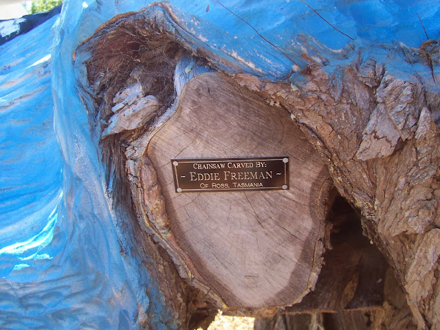
With a chainsaw and chisel, Tasmanian sculptor, Eddie Freeman, has breathed new life into an ageing Macrocarpa Pine Tree on the site of the old Cable House for the Tasmania to Victoria telegraph link.

The sculpture features a mother whale and her baby, five penguins and cable men pulling in the telegraph cable.


The telegraph cable

The artist's credit


A telegraph line connecting Hobart and Launceston was completed in 1857 in 1869 a submarine telegraph cable ran from Low Head, Tasmania to Western Port, Victoria.

The key to future growth in trade and commerce was a connection to the other state capitals.

There were 117 miles of cable at a final contract cost of £53,000 laid and made operational. Unfortunately the cable was constantly out of service due to faults undersea and by January 1861 it was abandoned.

An enduring cable link was established between Cape Otway on the Victorian mid-south coast, through to King Island and, ultimately, Launceston, Tasmania, the £70000 cost paid fully by the Tasmanian Government and it was opened in 1869.